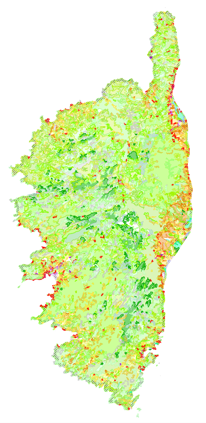
Bd CORINE Land Cover 2000 en Corse
Cartographie informatique d'occupation des sols réalisée en 2000 dans le cadre du programme européen CORINE LANDCOVER et distribuée par l'Institut Français de l'Environnement
Simple
- Date (Revision)
- 2019-08-23
- Date (Creation)
- 2008-02-13
- Citation identifier
- https://georchestra.ac-corse.fr/geonetwork/srv/fre/catalog.search#/metadata/MT1181055000079
- Point of contact
-
Organisation name Individual name Electronic mail address Role Ministère de la Transition écologique et solidaire
Point of contact
-
Régions de France
-
-
CORSE
-
-
GEMET - INSPIRE themes, version 1.0
-
-
Occupation des terres
-
- Keywords
-
-
agricole
-
agriculture
-
CORINE
-
espace
-
LANDCOVER
-
forêt
-
occupation
-
sol
-
territoire
-
urbanisation
-
milieux
-
inventaire
-
connaissance
-
institut
-
programme
-
européen
-
français
-
données ouvertes
-
millesime
-
2000
-
- Use limitation
-
Aucune condition ne s’applique données ouvertes
- Access constraints
- Copyright
- Use constraints
- Copyright
- Spatial representation type
- Vector
- Denominator
- 100000
- Language
- Français
- Topic category
-
- Imagery base maps earth cover
))
- Reference system identifier
- RGF93 Lambert-93 (urn:ogc:def:crs:EPSG:6.11:2154)
Spatial representation info
- Distribution format
-
Name Version ESRI Shapefile
1.0
Distributor
- Distributor contact
-
Organisation name Individual name Electronic mail address Role Institut Français de l'Environnement
Point of contact
- OnLine resource
-
Protocol Linkage Name OGC:WMS
https://georchestra.ac-corse.fr/geoserver/wms?SERVICE=WMS&REQUEST=GetCapabilities dreal:clc_2000
OGC:WFS
https://georchestra.ac-corse.fr/geoserver/wfs?service=wfs&REQUEST=getcapabilities dreal:clc_2000
WWW:LINK-1.0-http--samples
https://observatoire-v.ac-corse.fr/indicateurs/select_carto?ncarto=clc_2000&id=MT1181055000079 Lien de création de cartographie internet dédiée
Data quality info
- Hierarchy level
- Dataset
- Statement
-
Voir contacts
Metadata
- File identifier
- MT1181055000079 XML
- Metadata language
- Français
- Character set
- UTF8
- Parent identifier
-
Bd CORINE Land Cover 1990 en Corse
MT1181055000078
- Hierarchy level
- Dataset
- Hierarchy level name
-
dataset
- Date stamp
- 2023-05-02T15:56:02
- Metadata standard name
-
ISO 19115
- Metadata standard version
-
2003 Cor.1:2006
- Metadata author
-
Organisation name Individual name Electronic mail address Role Direction régionale de l'Environnement, de l'Aménagement et du Logement de Corse
Point of contact
Overviews
Spatial extent
Provided by
